Just shred it.
Mountain Biking Guide
More than 2,000 miles of singletrack trails wind through Southwest Idaho.
Here, there’s no limit to the adventure. You can coast through mountain meadows. You can put your downhill skills to the test. You can climb switchbacks through narrow canyons to find panoramic desert views.
Choose your own path. We promise the views will be worth it.
The Owyhees
Photo courtesy of Idaho Department of Commerce
Coast through sweeping desert plateaus under clear blue skies. Navigate tight switchbacks along rugged canyon walls. Feel the desert wind on your face as you breathe in the scent of sagebrush and juniper.
Here, you’ll probably be the only rider for miles around.
The Owyhee Canyonlands Wilderness is arguably one of the most remote, uninhabited and unexplored regions in Idaho. The often vacant trails are best experienced in late spring, when the wildflowers bloom and the desert grasses turn green.

Trails to Explore:
Wilson Creek Tour This 17-mile singletrack loop will take you through a steep climb up Wilson Creek and a challenging drop into Reynolds Canyon, finishing with a relaxing coast through the valley below.
Directions: From Boise, take 1-84 west to Nampa, turn south onto ID-45 to Melba and drive along Wilson Creek Road to the main Wilson Creek Trailhead.
Swan Falls After walking your bike across the Swan Falls Dam and taking in the view, you’ll glide along sandy flat trails along the Snake River. About 6 miles in, you’ll find some petroglyphs carved into volcanic rocks, left by nomadic tribes thousands of years ago.
Directions: From Boise, take I-84 west to Meridian, turn south onto ID-69 south past Kuna to Swan Falls Road and park near the Swan Falls Dam.
Boise Foothills
Local riders grabbing coffee at Cafe Mule
Look out at the skyline of Boise and you’ll see the golden foothills rising above the Idaho State Capitol Building. A network of more than 190 miles of trails loop through the high desert just north of town, criss-crossing through plateaus, creeks, ridges and canyons.
Here, you don’t even need to drive out to the trailhead. From Downtown Boise, you can ride into the high desert and be back home by happy hour.
Local’s Tip: During the summer, be on the lookout for Cafe Mule — the world’s one and only mule-powered coffee service.
Trails to Explore:
Polecat Loop After a challenging climb up steep switchbacks, you’ll glide along a narrow ridgeline that offers a view of Boise on one side and rugged mountains on the other. As you coast back down to the parking lot, just relax and take in the view.
Directions: From Boise, take Collister Road north until it ends, and park at the dirt lot near the Polecat Gulch Trailhead.
Camel’s Back and Hulls Gulch Reserve Climb up Camel’s Back hill, and you’ll find miles of trails looping through Hulls Gulch Reserve. Depending on the route you choose, you’ll find creeks lined with willows and wildflowers or rocky ridges with epic views of Boise — each one with a challenge of their own.
Directions: Drive out to Boise’s North End. Take 13th Street north to Camel’s Back Park.
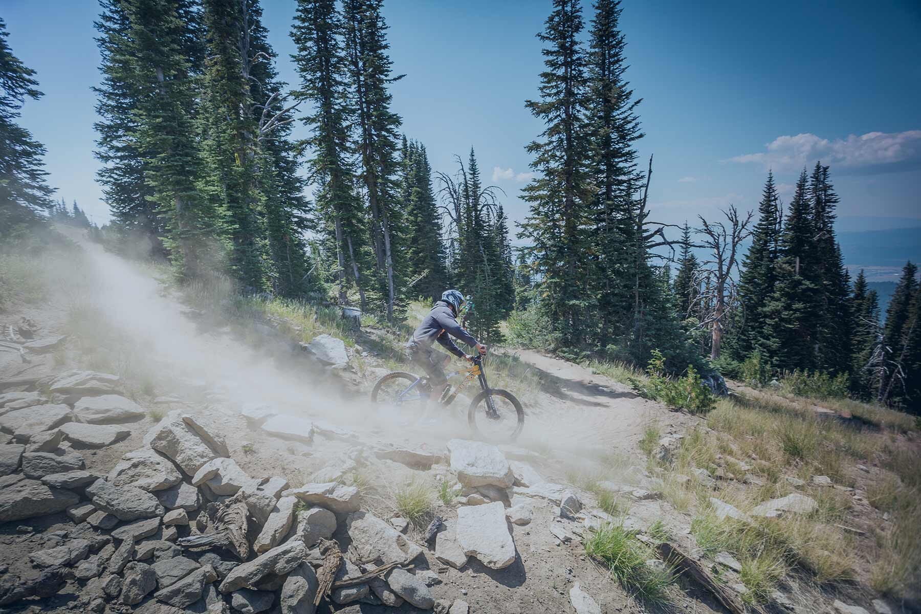
Bogus Basin and Shafer Butte
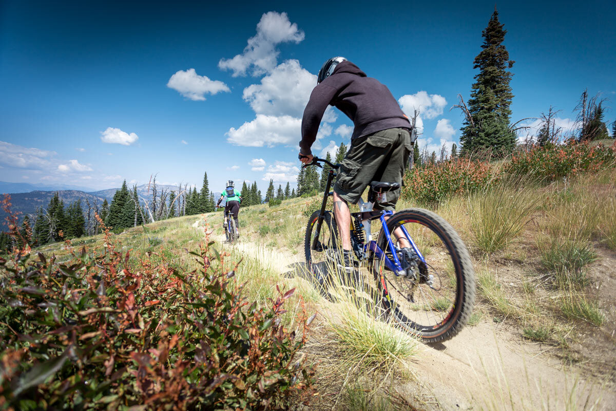
When summer hits, the ski runs at Bogus Basin melt away to reveal miles of singletrack crisscrossing through forests, ridges and meadows.
Here, you’ll be surrounded by dense wilderness while taking in views of America’s fastest growing city.
Trails to Explore:
‘Around the Mountain’ Trail This local secret should definitely make your summertime bucket list. The 7-mile singletrack route literally takes you on an easy ride around Bogus Basin. The views of the mountains you’ll catch between the trees are… well, you really have to experience them for yourself.
Directions: From Boise, head up Bogus Basin Road until you reach the ski parking lot. Take the trail that begins just under the ski lift.
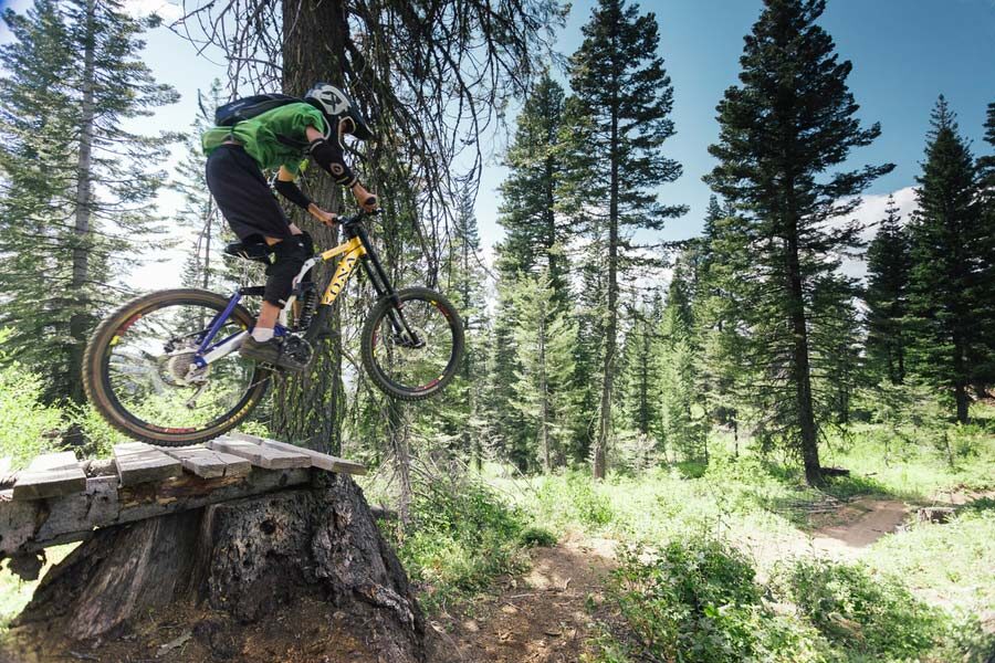
Bogus Mountain Tour Ride through fields of wildflowers and alpine forests. If you’re ready for a challenge, try your hand at some stunts while navigating over logs, rocks and ramps along the way.
Directions: From the Simplot Lodge at Bogus Basin, head up Deer Point Trail. From here, you’ll continue onto a series of trails all over the park: Elk Creek Trail, Pack Trail, The Face, Brewers Byway, Shindig Trail and eventually Morningstar Trail.
McCall and Payette National Forest
Here, the dense forests are filled with hidden trails waiting to be explored. You’ll find yourself in deep wilderness, surrounded by towering ponderosa trees.
When you’re done hitting the trails, you can head back into McCall for a cold beer by the lake.
Trails to Explore:
Jug Mountain Ranch Explore rugged backcountry in the shadow of Jug Mountain’s 8,310-foot peak, just 20 minutes southeast of McCall. Whether it’s catching some air along the Berm N Ernie or testing your technical side on the Vandelay, you’ll have a range of trails and terrains to choose from.
Directions: From McCall, drive south on ID-55 and turn east on Lake Fork Road until you hit Jug Mountain Ranch.
Ponderosa State Park Ride along flowing singletrack as you take in views of one of the largest lakes in Southwest Idaho. The trails in Ponderosa State Park loop around a peninsula that’s surrounded by the blue waters of Payette Lake.
Directions: From Downtown McCall, take Davis Avenue north until you hit Ponderosa State Park.
Brundage Mountain Resort You’ll find some of the most powder-packed ski runs here in the winter — but summertime is mountain biking season at Brundage. Ski lifts allow you to access the best parts of the mountain and put your downhill skills to the test.
Directions: From McCall, take ID-55 north and turn off onto Brundage Mountain Road. The resort is just over 4 miles down the road.
Go ahead. We dare you to take the road less traveled. Whether you venture out to the Owyhees or explore Bogus Basin, the ride will always be worth it.
Here in Southwest Idaho, you’re free to forge your own path.