Taking the road less traveled.
Experience the Oregon Trail
We sent a Boise native to explore the Oregon Trail Reserve, just 17 minutes from downtown Boise, and give you a local’s insight to the iconic hike.
Below my feet, I can see the well-worn ruts of the wagons that once traveled this same trail, over 100 years ago.
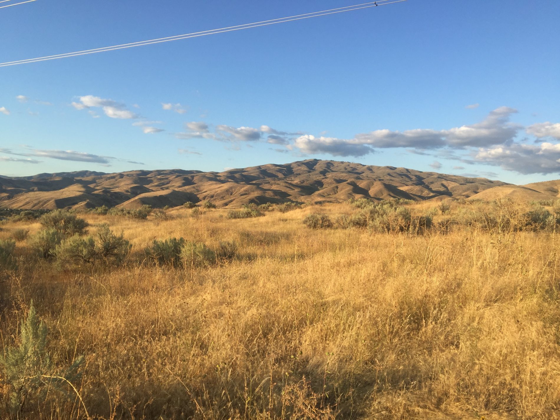
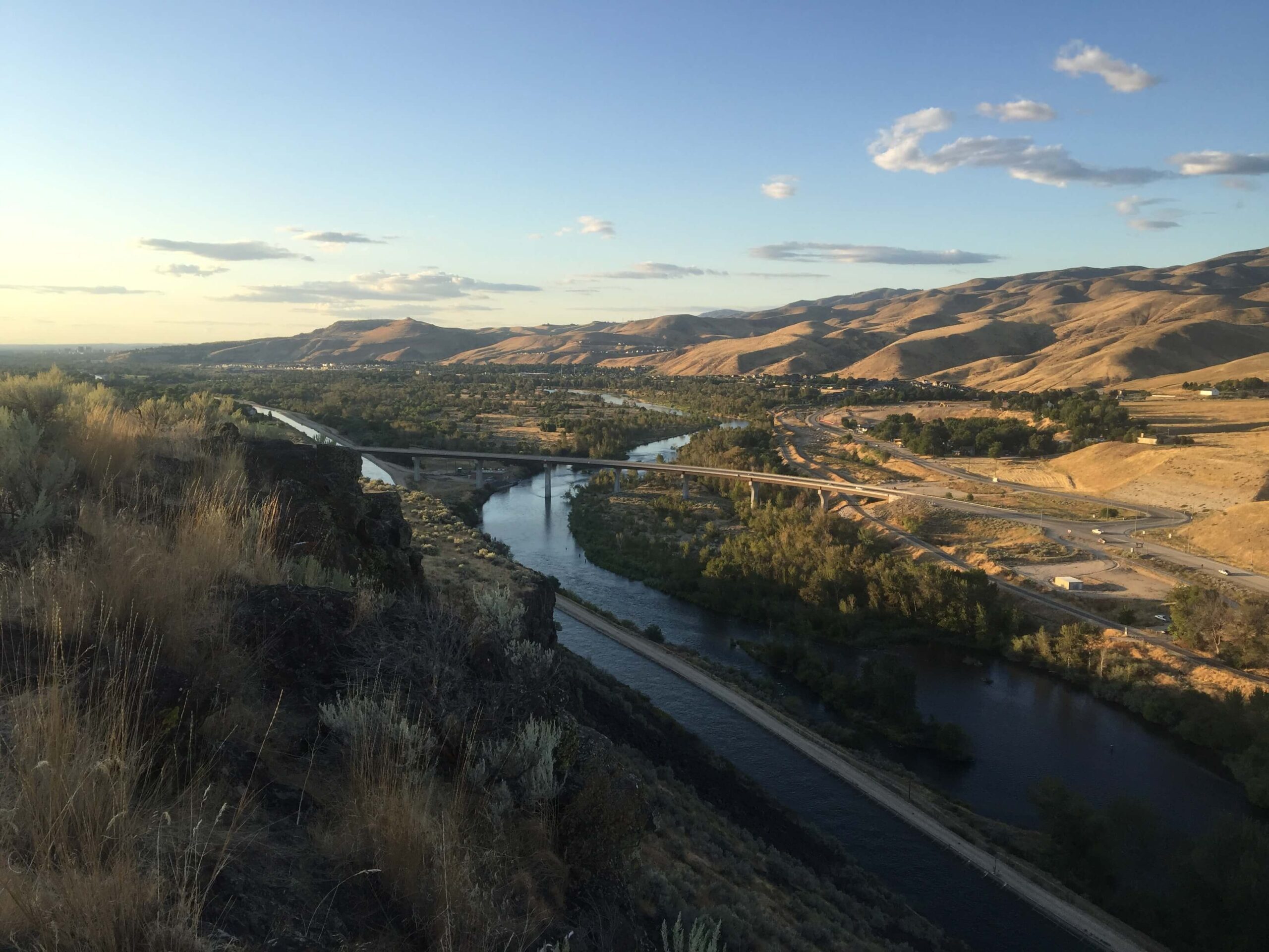
The ridge keeps on getting steeper, but I power forward. Once I get to the top, I can see the blue Boise River and thousands of green trees cutting right through the desert valley.
“No wonder why they call it the City of Trees,” I thought, taking in the breathtaking view.
A Dangerous Journey
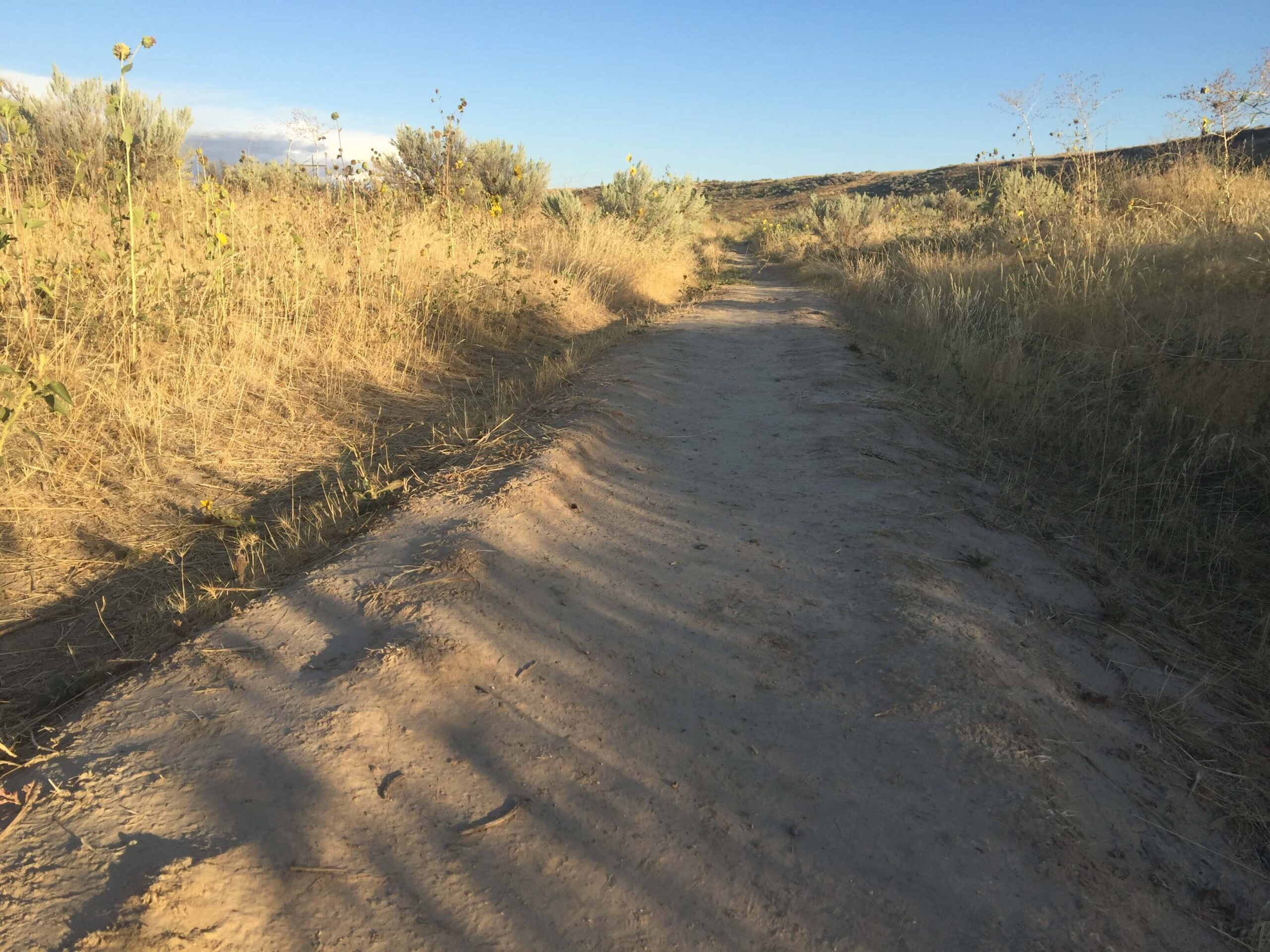
Walking along the same path pioneers used over 100 years ago.
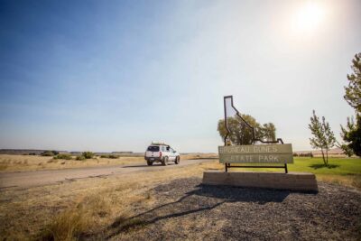
This is the Oregon Trail Reserve, a 77-acre site right outside Southeast Boise. The trails here follow right along the path of the original Oregon Trail, which the pioneers used to travel to the West.
Back in the 1800s, Boise was an important stop along the Oregon Trail. It was the only trade post for miles, and many died just trying to get here. An estimated 400,000 pioneers used the 2,000 mile trail and its three main branches to start a new life in the West — approximately 10 percent of them died along the way.
Most of the deaths were caused by cholera, but countless others died of starvation, accidental shootings or skirmishes with Native American tribes. It’s essentially the nation’s longest graveyard.
If the pioneer graves were evenly spaced along the length of the trail, there would be a grave every 50 yards from Missouri to Oregon City.
Creepy, yes. But even still there’s something hauntingly beautiful about this place. The clear blue skies, the desert wind blowing through the sagebrush and wildflowers, the rugged rock faces hanging over the Boise River… The landscape is lonely and yet strangely comforting.
Rather than riding in the wagons or on horseback, most pioneers walked this trail, just the way I am now. Weighed down with supplies and pulled by a couple oxen, most wagons would travel at a sluggish pace of 2-3 miles per hour. Mothers, fathers and children would walk up to 15 miles a day in the desert, following the wagon train from dawn till dusk.
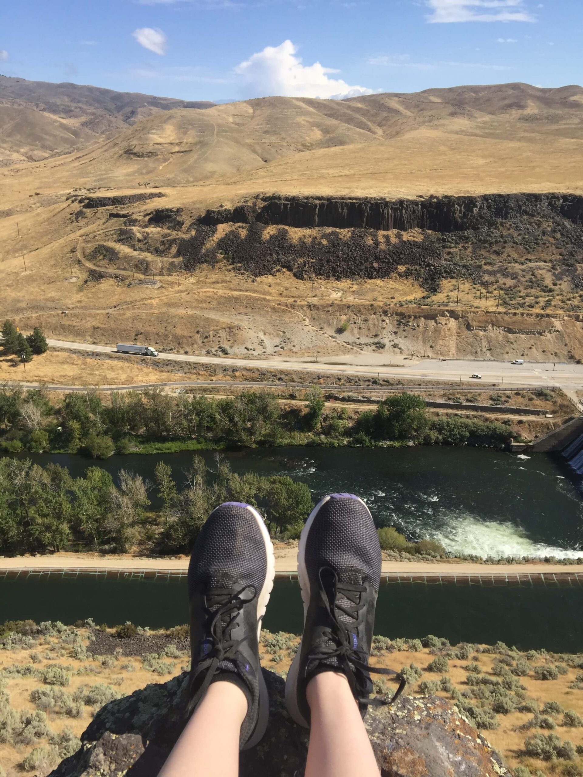
Dangling my feet over the Boise River.
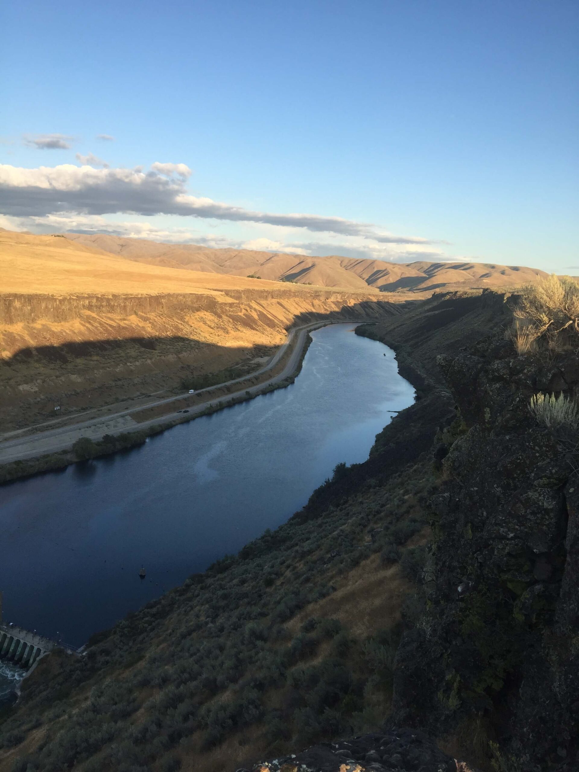
Not only was the desert hot and unforgiving, there were a number of sheer rock faces and cliffs lining the canyon around the Boise River. Reaching the river (let alone crossing it) was extremely dangerous, but it was a total necessity. Pioneers had to lock up the wheels on their wagons and lower them using chains and ropes. Most groups took a footpath called the Kelton Ramp to safely descend into the canyon. (You can see it just a few miles down from the trailhead along Highway 21.)
Sitting with my feet dangling over the edge of one of these rock faces, the powerful blue waters of the river below look so inviting from the 90 degree heat.
Local’s tip: Floating is the best way to experience the Boise River. Check out our river floating guide for details.
A View of Hope
This is why we call Boise the City of Trees.
As I walked further along the trail and the sun climbed higher in the sky, I couldn’t imagine doing this for more than a few miles. It quickly made sense why the trees and rivers surrounding Boise were such an unforgettable sight to these people.
The pioneers actually named Boise using the french word “Boisé,” which translates to “wooded.”
As a kid, I thought it was a joke. I mean, come on, it’s the desert — we don’t have that many trees. But to the pioneers, the terrain was such a stark contrast from the barren desert they had walked through for weeks.
To them, seeing Boise meant supplies, shade, water, shelter, and even more importantly… hope. Seeing the city from the lookout, I could feel that same hope too.
Older Than Time
Basalt cliffs overlooking the Boise River left from underwater volcanoes millions of years ago.
But the land has a rich history that stretches back even further than the first pioneers who passed through. Thousands of years ago, nomadic tribes moved in time with the seasons, following the path of migrating game. To them, home was everywhere and nowhere at the same time.
The nomadic tribes of the Shoshone and Bannock people developed settlements, hunted and farmed this land for over 14,500 years.
Further up the trail from the lookout, there are still petroglyphs — prehistoric rock carvings — etched into the towering basalt rock faces along the trail. These carvings include maps of old hunting grounds, legends and tribal histories, all preserved thousands of years later. Even after centuries of winters, fires and floods, the stories still remain.
Tracing the etchings with my fingers, I think it’s unreal to see something so old, made by the hands of someone who lived in a world so entirely different from the one I live in now. Here I am, just miles outside the fastest growing city in America and I’m looking at something that was carved thousands of years ago.
And the terrain itself is even older. This desert once used to be part of a sea that stretched as far as the eye could see, lush and full of life. In fact, the basalt rocks the carvings are etched are hardened lava leftover from underwater volcanoes millions of years ago.
The waters of the Boise River still teem with bass, trout and steelhead. Plan a fishing trip with our fishing guide.
Still Wild
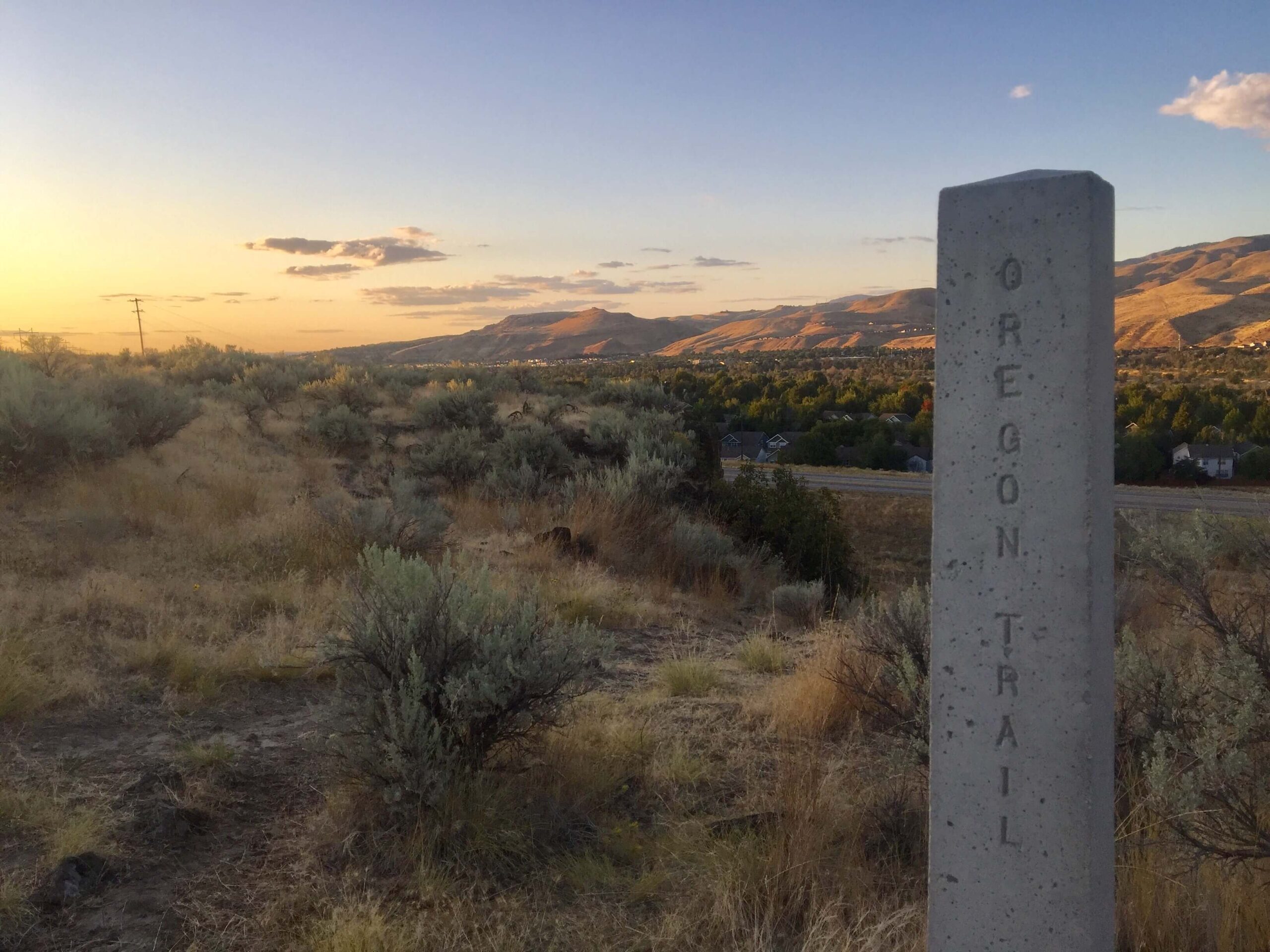
Historic mile post marking the path of the original trail.
So much has changed since then. The sea dried up. Settlements grew into towns and cities. The land is constantly evolving.
And yet it’s still distinctly wild here. Aside from a jogger or two and a family walking their dogs, I’m the only one out here for most of the hike. The sounds of the highway and the city quickly fade in the desert wind.
Over the course of just two miles, I’ve seen a raptor circling slowly above me, the sunlight outlining its feathers. I’ve nearly stepped on a snake. (It was entirely harmless.) I’ve watched a whistle pig — Idaho’s nickname for the groundhog — dart across the path and back into the sagebrush. I’ve stopped to smell the flowers (literally). Part of me feels like the first person to step foot out here, even though I know countless others already have.
Despite how much time has passed, Southwest Idaho will always be a part of the Wild West. Lonely and dangerous. Haunting and beautiful. Untouched and untamed.
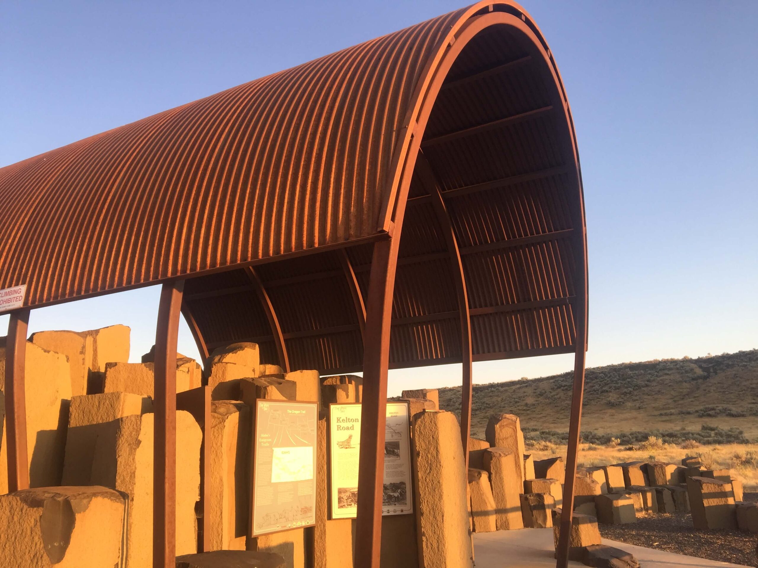
This steel sculpture was built by a local Boise artist to resemble an old wagon rolling across the desert.
Getting There:
From Downtown Boise, get on I-84 east toward Mountain Home. Take Exit 57 toward ID-21 and Idaho City. Turn left on ID-21 and drive a few miles down the road. You’ll see a sign and parking lot for the Oregon Trail Reserve on your right. The trailhead starts right at the end of the parking lot, next to the interpretive center.
Nearby Attractions:
Drive 10 minutes up the road and you’ll find yourself at Lucky Peak — one of the largest reservoirs in Idaho — where you can go boating, fishing, paddleboarding, swimming and more.
30 minutes further up the road is Idaho City, a ghost town known for rugged ATV trails, relaxing hot springs and historic buildings.
The heart of Downtown Boise is only 15 minutes away.