off the beaten path
4 Hidden Hikes in SW Idaho
Secluded hot springs. Epic panoramic views. Secret mountain meadows.
These are just some of the sights you’ll see on a hike in Southwest Idaho.
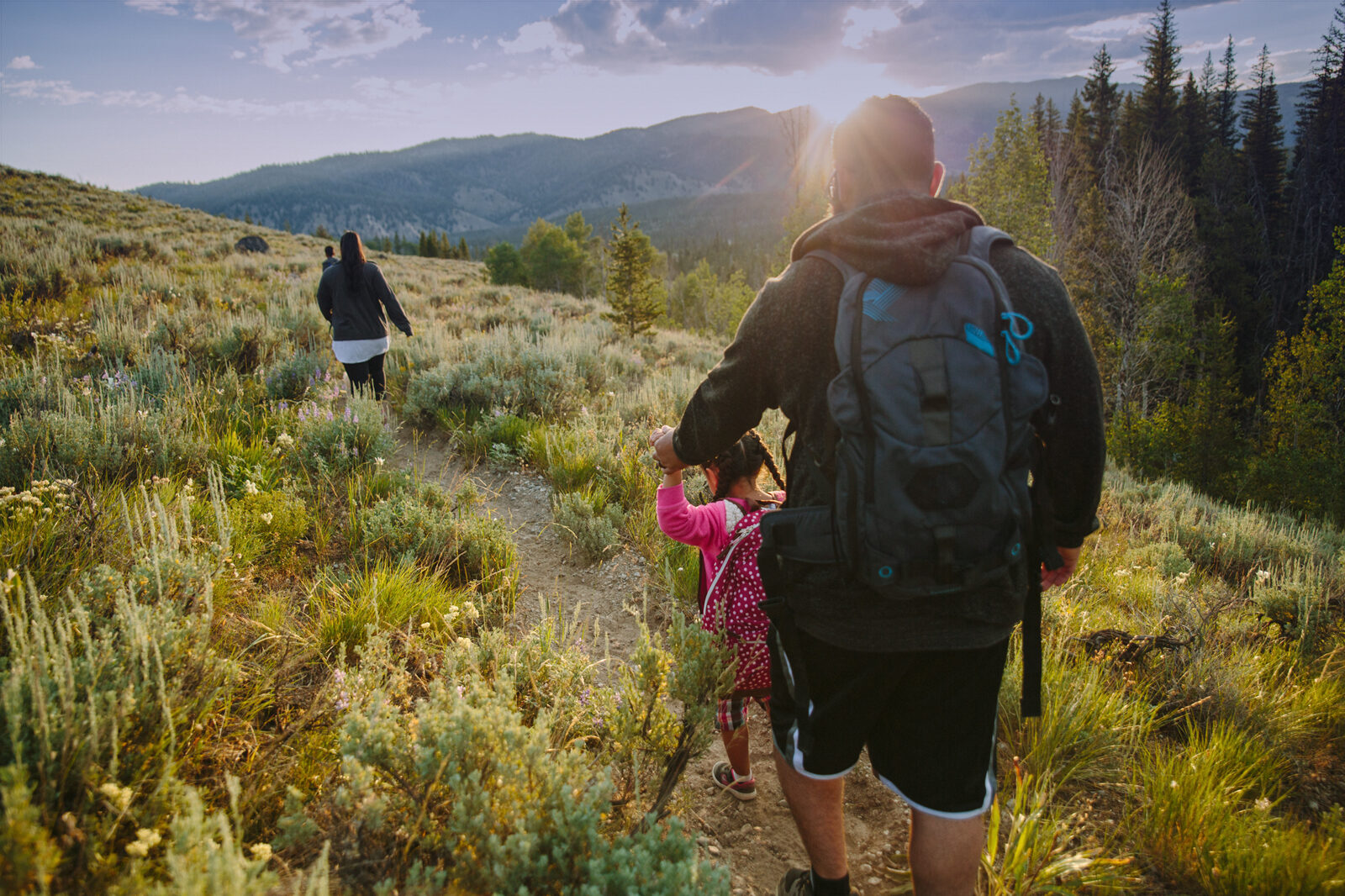
From the Owyhees to the Central Mountains, we have hundreds of miles just waiting to be explored. We’re going to give you the rundown on four of our favorite hidden hikes in the region, from quick hikes with the kids to challenging day-long adventures.
Just remember to adventure responsibly!
Jump Creek Falls
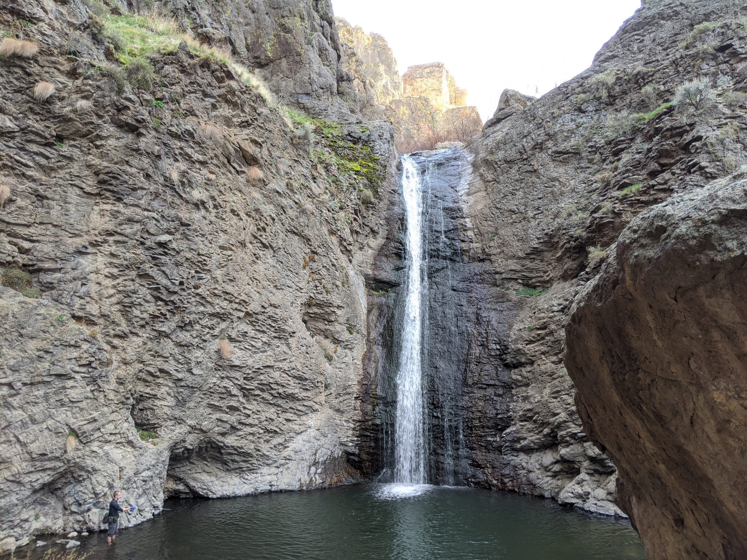
Take a short hike to see the largest falls in Owyhee county, a perfect oasis in the high desert.
Length: ½ mile round trip, great for taking the kids
Nearest town: Marsing
Getting there: From Boise, take I-84 west toward Nampa. Take the Karcher Road exit onto ID-55 and you’ll eventually turn left onto old hwy 95. Turn right onto Poison Creek Road, follow it a few miles and turn left on Jump Creek Road. You’ll continue down the road until you get to the parking lots next to the trailhead.
The trail: Take a short stroll along a small, bubbling creek, with rocky canyon walls towering hundreds of feet above you. At the end of the trail, you’ll find a 60-foot waterfall cascading into a clear pool below. The cool waters are perfect for a quick swim.
Best time to go: Hit the trail in late spring. This is when the flow of the waterfall will be the strongest.
Blue Lake
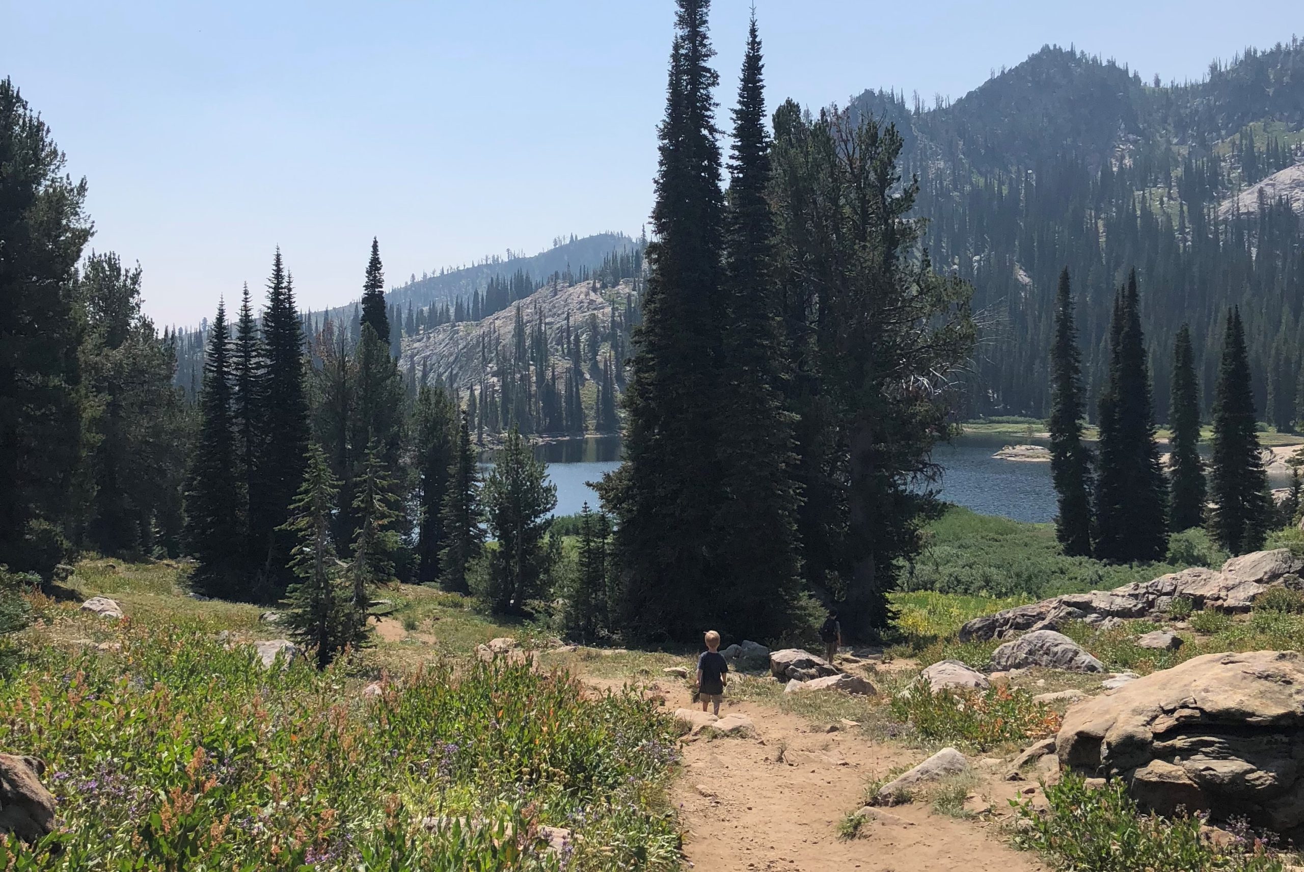
Discover a brilliant blue lake hidden in the mountains outside Cascade.
Length: About 1 mile to the lake, with a loop around the lake
Nearest town: Cascade
Getting there: From Cascade, take Hwy 55 south and turn onto Forest Road 446. You’ll continue along this for 11 miles. You can park at the trailhead.
The trail: From the trailhead, you’ll make a slow, gradual descent to the lake. Even from the trail, the lake is a striking pure blue (just like its name). Once you reach the shore, the waters will feel so cool and refreshing. The lake is surrounded by rugged mountains and rolling meadows dotted with wildflowers.
Best time to go: Pick a summer morning in late June or early July. The snow will be melted by then and the wildflowers will be blooming.
Polecat
Wind along the ridges of sagebrush foothills overlooking the Treasure Valley.
Length: Take a 5.8-mile loop on Polecat Trail #81, or take a shortcut with Doe Ridge Trail #82 or Quick Draw Trail #83.
Nearest town: Boise
Getting there: From Downtown Boise, turn north onto Collister Road. After a few miles, Collister will turn into an unpaved road and lead to a parking lot next to the trailhead.
The trail: From the parking lot, you’ll climb up steep switchbacks on a narrow singletrack trail. After a good climb, you’ll find yourself on a ridge with far-reaching views of Boise and Bogus Basin. You can decide to take the longer loop as you wind along the sagebrush ridges, or take one of the shortcuts down to the trailhead. Remember to take in the stunning views of the valley along the way.
Best time to go: Go in late spring or early summer. The foothills will still be green, with quite a few wildflowers in bloom. Try to go near sunset or sunrise — the views will be even better.
Stack Rock
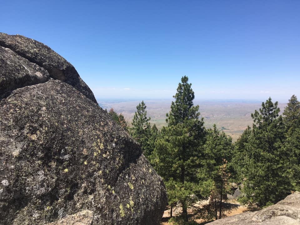
Take in epic, 360-degree views from a craggy peak above Boise.
Length: Roughly 9 miles out-and-back, typically takes between 3-4 hours
Nearest town: Boise
Getting there: From Boise, drive 13.1 miles up Bogus Basin Road. Turn into the small gravel parking area to your left. The trail will start from here, and there are plenty of signs to mark the way.
The trail: You’ll wind through lush alpine forests on relatively flat singletrack, shaded by the towering ponderosa pines. Once you’re about a half mile from Stack Rock, you’ll begin a quick, steep climb up the summit. As you grind uphill, the craggy peak of Stack Rock will emerge from the pines. Once you reach the rock, the trail opens up to a stunning 360 degree view of Boise and beyond.
Best time to go: Fall. The cooler weather makes the climb easier, and the autumn colors are stunning from the top.
As you venture further into Southwest Idaho, you’ll realize there is so much to discover along the trails.
Whatever you discover, remember to respect the trails and any wildlife you meet. Even today, Southwest Idaho is still wild — Let’s keep it that way.